Walk This Talk
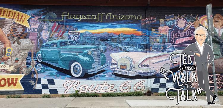

Who Ever Heard of this Lost Highway?
Flagstaff’s little-known original alignment of Route 66
Few people know that highway officials abandoned part of Route 66 after traffic from Dustbowl states clogged downtown Flagstaff in the mid-1930s. You’ll uncover the secrets of the original alignment when you put on walking shoes and dial your phone to the “Walk This Talk” audio tour. Tracing the little-known original alignment of Route 66, you’ll follow audio instructions delivered by your phone for this self-guided walking tour. As the reliable technology steers you through Flagstaff’s Southside Historic District, you’ll stop to hear pre-recorded oral histories about what happened along the way. Hidden messages in street art, competition for lost business, and unsolved murders are some of the stories shared.
Just like the Route 66 motorists of old, you’ll discover something new beyond each turn. Pedestrian signs at locations along the Walk This Talk route notify you to call toll-free 928-218-2926 to hear pre-recorded oral histories at specific sites, or you may scan the QR code on this page for online audio. The self-guided tour begins on the north side of the Flagstaff Visitor Center (One East Route 66.)
Take the virtual Tour!
Listen to a happy visitor who Walked the Talk here: Audio File
Want to go where everybody knows your name?
You might recognize the voice of “Cheers” star Ted Danson, welcoming you to Flagstaff when you dial-in to the audio tour. Danson spent his formative years in this mountain town while his father served as director of the Museum of Northern Arizona. The tour, narrated by local author Rose Houk, takes about an hour to complete and windups at the corner of Mike’s Pike and Milton Road.
Round up some friends and family, bring your smartphones and earbuds and start walking. You may purchase earbuds or headphones at the Flagstaff Visitor Center to heighten your experience, as the downtown traffic and train can be noisy.
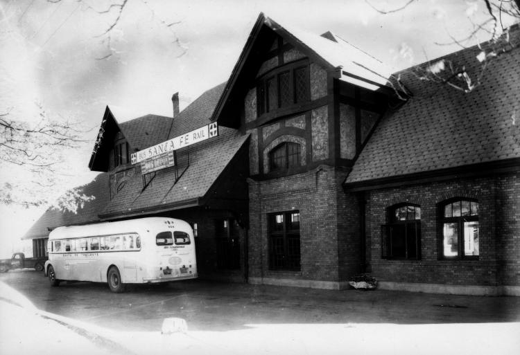
1. Historic Flagstaff Depot
Home of Flagstaff Visitor Center and Amtrak
In 1926, times were a-changin’—the federal government officially commissioned Route 66 as a US highway at the same time that The Santa Fe Railway completed the Flagstaff depot. A transition from rail travel to automobile road tripping—and a new way of American living—was about to begin.
As more Americans took to the road, traffic increased. In 1934, a Route 66 underpass was built to help traffic flow. The downtown Flagstaff section of Route 66 was rerouted from the original alignment on the south side of the railroad tracks to Santa Fe Avenue on the north, where it remains today.
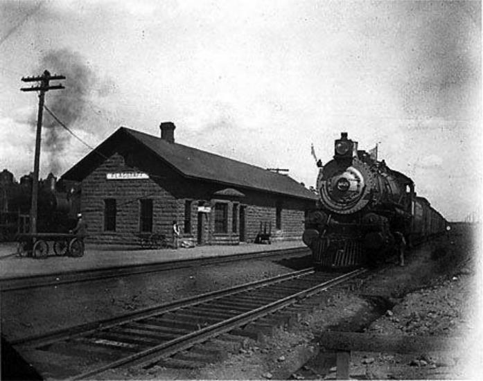
2. I’ve Been Working on the Railroad: Santa Fe Plaza
At the southeast corner of Historic Route 66 and South San Francisco Street, you’ll see a red stone building, Flagstaff’s first permanent train depot across the street. In front of the low Moenkopi sandstone structure is Santa Fe Plaza with benches and a bronze sculpture titled “Gandy Dancer” by Sedona artist Clyde “Ross” Morgan. The statue depicts a railroad worker driving railroad spikes with a spike maul.
Take caution crossing the tracks—about 100 trains per day rail through this crossing.
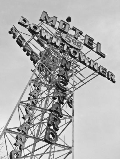
3. Deciphering the Mother Myth Mural
The Route 66 mural on the northwest corner of San Francisco Street and Phoenix Avenue takes its name from John Steinbeck’s book, “The Grapes of Wrath.” The novel describes families fleeing the Dust Bowl of the Great Plains to seek work in Arizona and California. In that classic book, Steinbeck named Route 66, “the Mother Road, the road of flight.”
Decipher the Mother Myth Mural by reading its story from right to left. Because Route 66 brought Americans from the East to the west during westward migrations, the artists painted the tale from right (east) to left (west.)
On this same corner but across the street is the Downtowner Motel, which operated as brothel, hotel, tourist and auto court and motel over the years. It is here that someone murdered a sleeping couple in 1916. High above is the Downtowner’s tall metal tower, erected in the 1930s to compete for lost business after Route 66 was relocated on the north side of the railroad tracks. The lattice mast looks like the radio towers that became so popular in that era.
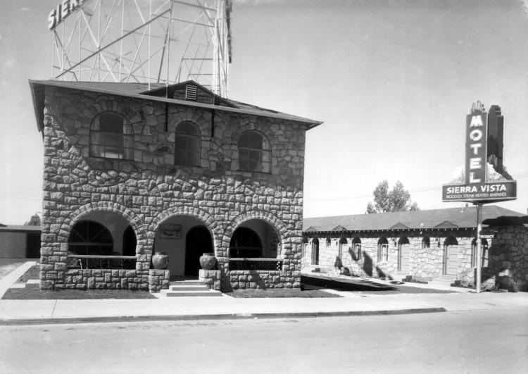
4. Rock on: Coconino Rowhouse and Sierra Vista Motel
Craftsmen used local Moenkopi sandstone, a sedimentary rock, to build the row house at 17 East Phoenix in 1926. You might recognize it as the same sandstone used to build the first permanent train depot and other historic buildings in Flagstaff. The row house was purpose-built as a boarding house and apartments, and you can tell that after all these years, it still serves the same purpose.
In contrast, the building material for The Sierra Vista Motel next door is a different local rock. This is igneous rock from nearby Mount Elden. Flagstaff lies on a volcanic field, and you’ll see this volcanic rock in many of the older homes and garden walls around historic downtown Flagstaff.
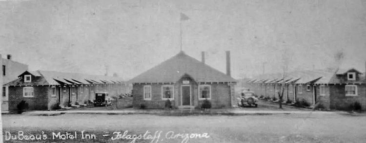
5. Lost Highway: Motel Du Beau Travelers Inn
Motel Dubeau at 19 West Phoenix is Flagstaff’s first Route 66 motel. Built in 1929 for the new breed of traveler, “auto tourists,” the motor hotel (later shortened to “motel”) catered to those lured by the open road. Note the U-shaped plan of the motel, which allows auto adventurers to park next to their room and then quickly move luggage from their car to their guestroom. Owner Albert Eugene Du Beau believed the innovative courtyard design was the first of its kind. In the 1930s, when the realigned Route 66 no longer passed his door front, Mr. Du Beau competed for lost business with an 80-foot tower sign.
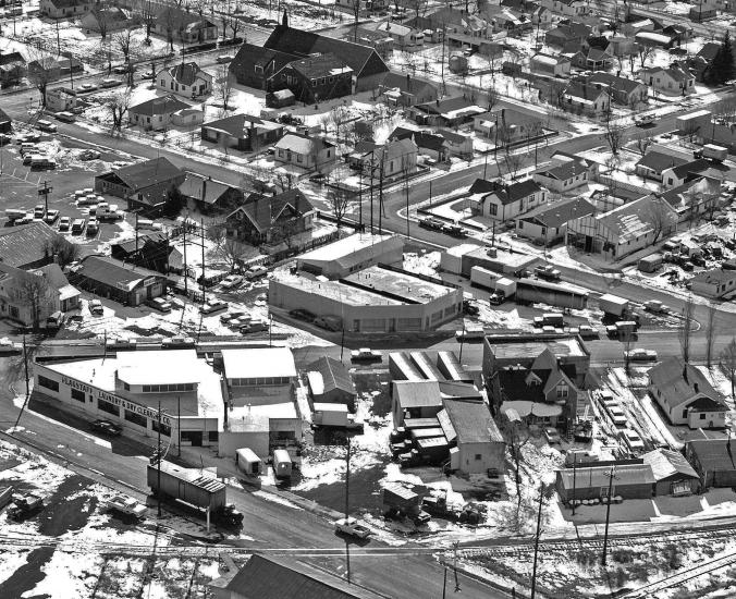
6. Original Route 66 Alignment: Mikes Pike
Mikes Pike follows the path of a railroad spur that ran from the main rail line to the lumber mill southwest of here in the late 1800s. The diagonal roadway is named for Michael Riordan, who, along with his brothers, developed the Arizona Lumber and Timber Company. Their family home is now the Riordan Mansion State Historic Park located one mile southwest of here.
The triangular building at the intersection of Phoenix Avenue and Mikes Pike is the Milum Building. Originally built as a commercial laundry in the 1920s, it is now home to Pizzicletta, Flagstaff Bike Revolution and Mother Road Brewing Company, which gets its name from—you guessed it—it’s location on the original alignment of Route 66.
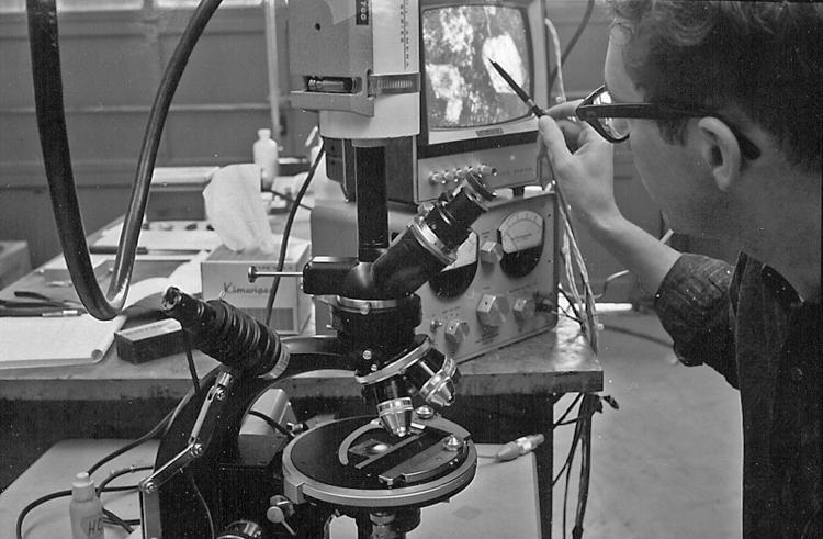
Photo caption: USGS astrogeologist Jerry Schaber examines rock slices in this photo of the lab from July 7, 1965.
7. Romancing the Stone: The Rock Lab
In the fall of 1965, the US Geological Survey leased this building at 16-18 Mikes Pike as a place where astrogeologists could analyze rock samples used in NASA astronaut education. Perhaps you didn’t know that every Apollo astronaut that walked on the moon trained in Flagstaff. Part of that training entailed what to look for when collecting rock samples on the lunar surface. Learn more about Flagstaff’s lunar legacy here.
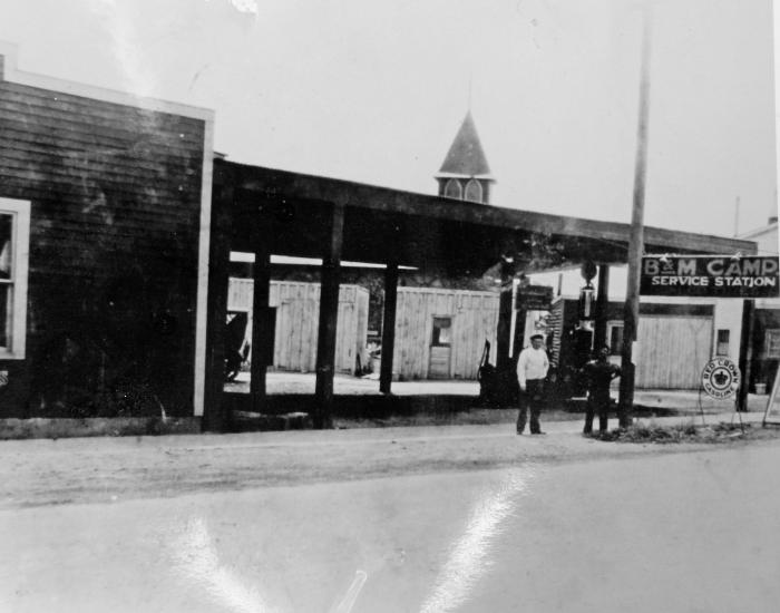
8. Get Your Kicks, Groceries and a Shower at B&M Auto Camp
At the corner of Mikes Pike and Cottage Avenue, the B&M Auto Camp provided Route 66 auto travelers with small cabins, camping, shower house, grocery store and service station. The camp is now a private residence, but you can see remnants of the cottages in the backyard.
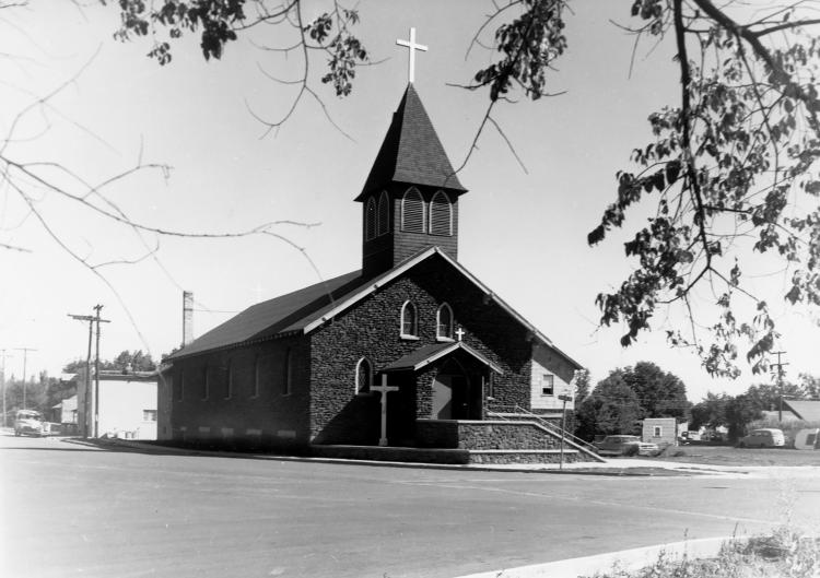
9. Blessings for the Road: Our Lady of Guadalupe Chapel
Built in the American Craftsman style in 1926 to serve Spanish-speaking parishioners, Our Lady of Guadalupe Church is on the National Register of Historic Places. The Southside neighborhood surrounding the church is one of Flagstaff’s oldest and included Basque sheepherders, African-American lumber mill workers and Italian and Mexican immigrants. Located at 302 S. Kendrick, it is within sight of the original Route 66 alignment.
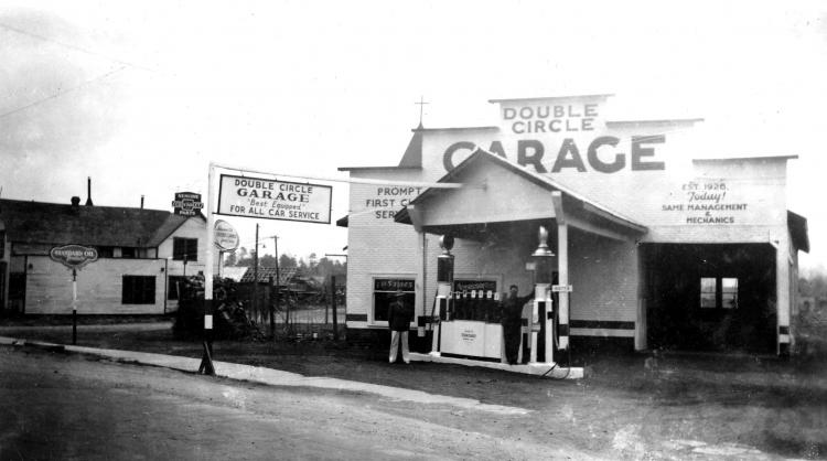
10. No Vacancy: Mikes Pike and Milton Road
Double Circle Garage serviced autos of Route 66 travelers starting in 1926. The façade, modern for its time, still displays a sign that is easy-to-read for motorists. The sign announces that this place, one of Flagstaff’s first gas stations, still repairs automobiles.
About the Author
Discover Flagstaff
Send An EmailDiscover Flagstaff features travel information for visitors to Flagstaff, Arizona and regional attractions like the Grand Canyon, Sedona, Navajo Nation and Route 66.


