Request A Free Travel Guide
The Flagstaff Travel Guide is an annual publication featuring the accommodations, restaurants, activities and useful travel information for the Flagstaff area.
Get The GuideExplore the scenic drives in and around Flagstaff that highlight the golden aspens, red hues of oak trees, and the changing leaves.
Leaf peepers will rejoice in exploring the scenic drives in and around Flagstaff that highlight the golden aspens and red hues of oak trees. Take the most scenic route to the Grand Canyon and enjoy winding through old growth aspen stands or head up the Snowbowl Road to enjoy not only a drive through the changing leaves, but amazing 360° views. Late in the season, take a trip south through scenic Oak Creek Canyon. Use the Discover Flagstaff Leaf-ometer to help prepare for the perfect time to enjoy each location. The meter is made up of a complete Fall color pallet and numerous locations around town perfect for leaf peeping adventures. Simply navigate the drop-down menu to plan for the perfect Autumn experience. From scenic drives through Oak Creek Canyon, up Mount Humphrey's, or on the way to Grand Canyon to walking around Flagstaff's serene Northern Arizona University campus, meandering through downtown, or taking a walkabout through the Arboretum, Flagstaff is a leaf peepers paradise each Fall.
Learn More About Leaf-Peeping in Flagstaff
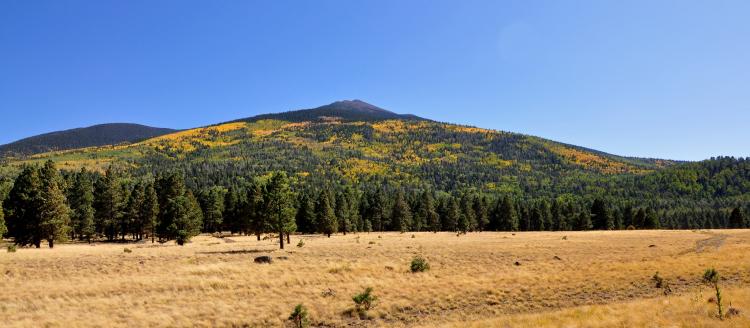
81 miles north of Flagstaff via Hwys 180 and 64 · 928-638-7888
Flagstaff is the gateway to the Grand Canyon, making a fun-filled day trip to this geologic wonder easy and convenient. Highway 180 winds below the majestic San Francisco Peaks, Mount Humphreys is the highest of these peaks and rises to 12,633 feet making it the highest peak in all of Arizona. This drive is scenic and has different beauty in each of the four seasons. In the fall the Aspen trees will turn a golden shade of yellow that delight amongst the sea of Ponderosa Pines. In the winter or spring, you can expect to see a beautiful snowy forest bounding with opportunities for winter recreation from the slopes at Arizona Snowbowl to the cross-country trails at Arizona Nordic Village. In the late summer months, the sunflowers will be in full bloom after being watered by the summer monsoons.
As you continue the scenic drive watch for elk, deer or other wildlife along the road. Kendrick Park is an open meadow that you will pass through that offers stunning views, and if you’re lucky enough you’ll see some of these native animals. As you drive you will notice the scenery start to change from Ponderosa Pines and Aspens to a more open landscape dotted with, volcanic craters, juniper trees, and sage bushes. This vegetation change will signal that you are close to the junction of Highway 64 where you’ll turn north to continue your journey to Grand Canyon National Park.
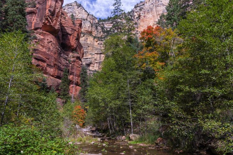
Coconino National Forest Red Rock Ranger District · 928-282-4119 · 29 miles south on Highway 89A
Travel south on scenic highway 89A from Flagstaff and drop below the Mogollon Rim and then into stunning Oak Creek Canyon. From the top of the switchbacks at Oak Creek Vista you can stop to gaze at the canyon below that you will soon be meandering through. There are local Navajo and Hopi artisans set up with booths to purchase authentic Native American jewelry, rugs and other artwork. Coconino National Forest rangers are on hand to answer questions and point out the mountains in the distance.
As you continue south you will descend 2,500 feet in elevation into Oak Creek Canyon. The landscape changes to lush creek-side vegetation with a canopy of trees and the crystal-clear waters of Oak Creek will begin to appear alongside the road. There are many stops along the way for a quick photo or a hike deeper into the red rock canyons. Hear the call of the canyon at the West Fork trail which follows the main tributary of Oak Creek as it winds around the red rocks. If you are lucky enough to visit in the summer time you can experience mother nature’s water slide at Slide Rock State Park. As you near Sedona and the end of this scenic drive the canyon will open to views of the red rock mountains in the distance.
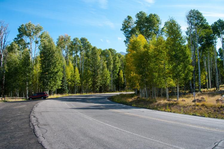
14 Miles north on Highway 180 and Snowbowl Rd
Arizona Snowbowl · 928-779-1951
Coconino National Forest Flagstaff District · 928-526-3600
Drive north of Flagstaff on Highway 180 through the ponderosa pine and aspen forests, turn north onto Snowbowl Road. The road meanders from the base of the mountain and another seven miles to Arizona Snowbowl’s parking area which sits at about 9,500 feet. The parking lot’s vistas are amazing. To see even more you can ride the scenic chairlift up to 11,500 feet to the top of the Agassi lift which provides views to the north of the Grand Canyon, south to the red rocks of Sedona and more.
For the more adventurous souls, there are many hikes that are accessible from this area from kid friendly Viet Springs Trail at the Lamar Haines Memorial Wildlife Area or strolling around Aspen Corner to more challenging hikes around the south western slope of the peaks on the Kachina Trail or to the highest peak in Arizona via the Humphreys Trail. After you’ve had your fill of the mountain, head back down Snowbowl Road to highway 180 where you can come back to Flagstaff or continue to Grand Canyon National Park.
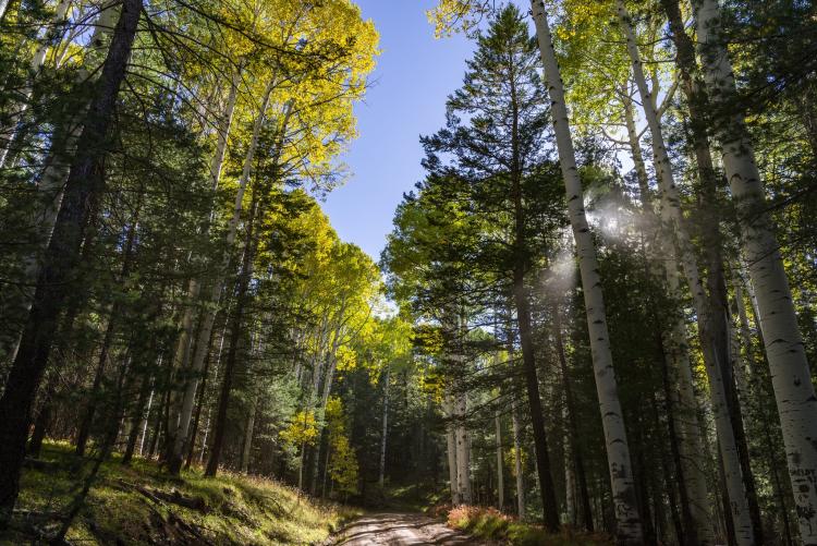
Coconino National Forest Flagstaff District · 928-527-3600
9 miles north of Flagstaff on Highway 180
Drive north of Flagstaff on Highway 180 for approximately nine miles, and at mile post 226 you will notice the first turn off for FS 151 Hart Prairie Rd. This gravel forest service road is accessible from May to October and offers great views of the aspen and Ponderosa pine trees and open meadows at the base of the San Francisco Peaks. This area is especially beautiful in early to mid-October when the aspen trees are in their golden hue for the fall. This forest service road is accessible to most vehicles. To receive a free motor vehicle use map for the Coconino National Forest stop at the Flagstaff Visitor Center or the Coconino National Forest Ranger Station.
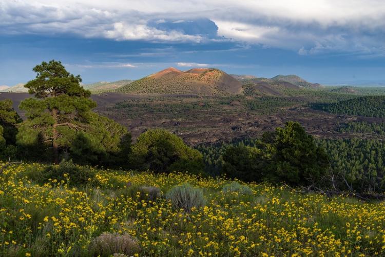
US 89 North turn right on Sunset Crater - Wupatki Loop Road
Sunset Crater Volcano is located along a 34-mile scenic loop road that takes you from open meadows and the beautiful Ponderosa pine forests surrounding Sunset Crater, through Juniper grasslands and view of the Painted Desert, to the open red rock landscape of the Wupatki Basin and Wupatki National Monument. Drive time along the Loop Road is about 1 hour.